


05.11.2015 - Westwind Ice Coring Expedition to South Georgia
 A joint venture by: Climate Change Institute University of Maine, Universidad de Magallanes Chile, University of Wollongong (Australia), Imperial College (UK) and Pelagic
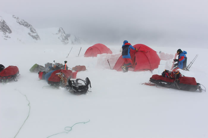
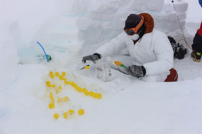 Processing ice cores in gale conditions
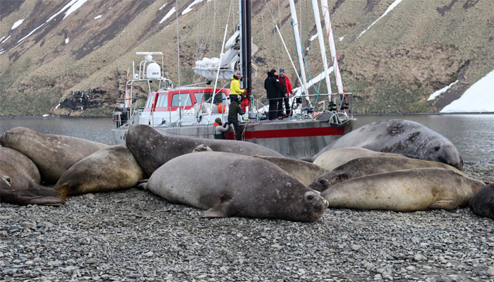
This October the team from the Climate Change Institute from the University of Maine returned to the island for their second reconnaissance expedition. In 2012 working from Pelagic Australis they were thwarted by tough conditions, but managed to get ice cores from the Szielasko Glacier on the Barff Peninsula in addition to old ice samples from the lower reaches of the Nordenskjold Glacier.
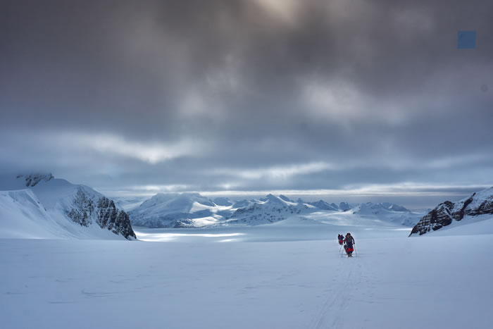
This time, with participation from the Universidad de Magallanes in Chile, the University of Wollongong in Australia and Imperial College London - with an extra week in hand, the mission was to ice core near the 900m level. From Pelagic Australis’ winter mountaineering expedition to the Trident Range last season, I recommended to team leader Professor Paul Mayewski that the Briggs/Esmark area would fit their purpose. 800 to 900m elevation and relatively easy access from the coast (as it ever can be on the island) with heavy sleds via King Haakon Bay, which is the classic start of the Shackleton Traverse.
First landing King Haakon Bay
Our team of four researchers and three in support including a senior glaciologist from Chile Dr. Gino Cassasa, landed at King Haakon in stormy weather on October 11th. While hanging in the lee of the Vincent Islands for three days we did a heavy carry of the drilling equipment, provisions and camping gear to 350 meters above the Shackleton Gap at the level of the Murray Snowfield. Having to carry on in less than optimum conditions as the clock was ticking (also thanks to a two day delay in the Lan Chile flight from Punta to MPA in the Falklands due to cross winds!) we left Pelagic Australis with our personal gear on October 15th, rejoined the depot and continued up the Briggs Glacier.
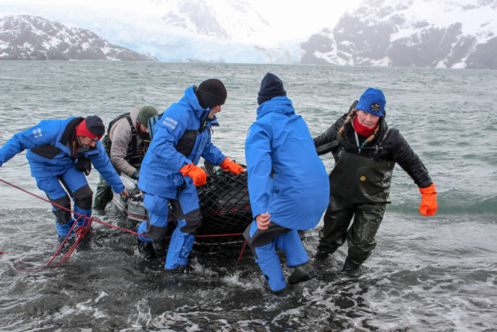
Ferrying gear to shore in tough conditions King Haakon Bay
First camp on the Murray Snowfield.
Gino’s job was to trail a 100m dipole radar antenna that measures the depth of the glacier ice – no mean feat in a strong gusts abeam of our track with visibility frequently down to nothing in white outs. Having to suffer several delays for antenna adjustment (described by Gino as the most extreme radar operation he has made to date!) we stopped far short of our intended camp under the Trident Range in the middle of the Briggs Glacier, with strong winds collapsing our less than perfectly built snow walls.
The radar rig had the mean depth of ice at 400+ meters all along the Briggs Glacier- the first time any depth of ice was measured on the island. Meanwhile, on that same day Pelagic Australis with skipper Dave and crew Thomas and Lizzy steamed for Elsehul Bay to install a GPS base station for Gino and also to deploy Phd student Ben Burpee to take water and sediment samples in two lakes in the Elsehul area. While the rest of us would be on the high ground Ben had 14 lake targets to sample between Elsehul and Moltke Harbour in the south central part of the island.
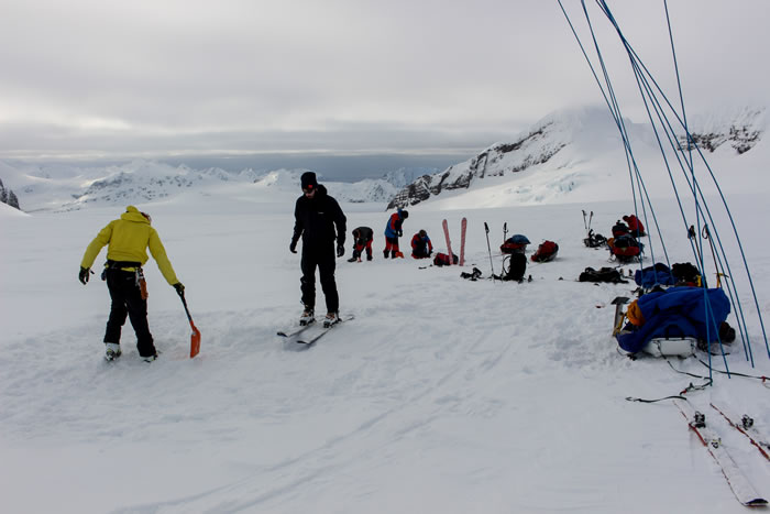
 Fine start on the Murray
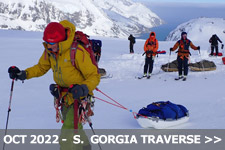
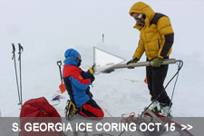
The next day things improved. In easier going we enjoyed (I speak at least for myself!) the slow steady climb from our camp at 500 meters up to below the Trident peaks at 870 meters. Though intending to carry through to the Esmark Glacier further on, Paul realized that the junction between the Esmark and the Briggs was an optimum feature for ice coring; a glacial dome, and therefore no need to go farther (all in favor at this stage!). Next morning, after a brief, but well deserved lie in the coring team dug a snow pit 50 meters from the camp and set up for the drilling.
Drill site camp at the top of the Briggs Glacier
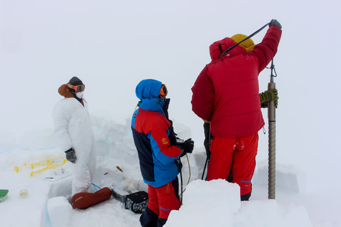
By 1230 they were taking their first ice core. Unlike in 2012 when the cores were sent frozen back to Maine courtesy of the British Antarctic Survey, the plan here was to ‘process’ the cores on site. This meant while Paul, Jeff and James were handling the electric powered drill, Mario, dressed in a white ‘moon suit’ sat in his snow lab and prepared each 10cm section of extracted core for bottling (an explanation that is a gross over simplification).
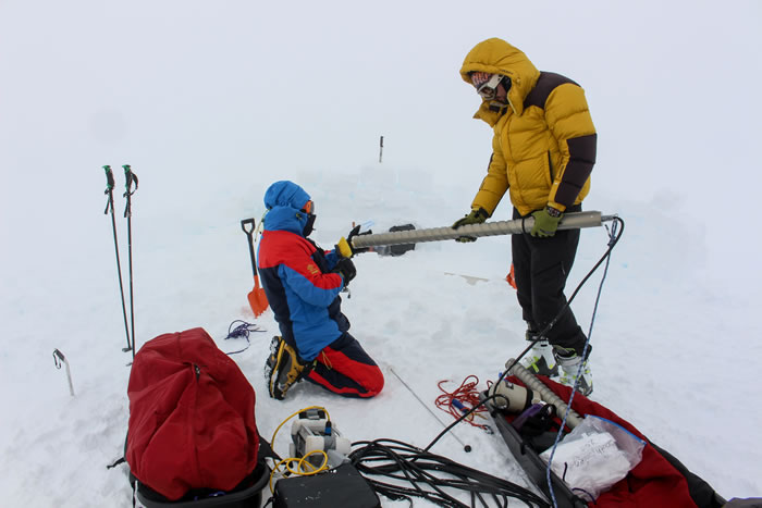
Jeff and James preparing the drill
First coring
Mario in his processing lab
These would be carried directly back to Maine and the liquid chemically analyzed. A long seven hours later, just on dusk, the full length of their power cable was reached at just short of 16 meters depth. The coring was complete but I must mention the last four hours were conducted in gale conditions by a very dedicated and focused team. My job was to supply the coffee and cookies . . . plus, Tom and I steered by Gino with a GPS described a figure of eight around the col in a white out with the radar antenna. 150m mean depth of ice at the drill site.
It was an immensely successful day and we all collapsed into our tents. Mission accomplished. The gale conditions persisted right through the night. The weather information from Dave on board had the wind abating by midday and sure enough it did. We broke camp and slid down the easy grade of the Briggs down to the Shackleton Gap and beyond to a beach camp at Assistance Bay within Possession Bay – where we found an emergency barrel left by the crew of Pelagic Australis. There are always surprises in these barrels and this time it was beers all around. We finished the day by playing frisbee with a plastic lid of a food bowl, beers in hand. Extraction was scheduled for 0900 the next morning, October 19th, which was accomplished on schedule.
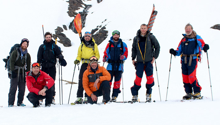
Group shot at the Shackleton Waterfall
Great to be back on board for sure, but more science was still to do and the weather was holding. We made for Fortuna Bay where Ben sampled a lake at the snout of the Konig Glacier. Then it was up to the Crean Lake along the Shackleton Walk to do the same, which required drilling through 60cm of ice (some core saved and carried down for G&T’s on board). An early evening ski down to the Shackleton Waterfall for a group photo and then easy snow all the way to the beach for the pick up ended another long, but satisfying day. We were all admittedly knackered.
Well, what was the point of it all and how will this help predict climate change? Changes in wind patterns in the Southern Ocean are key to what has happened in the past and will determine what might happen in the future. The persistent circumpolar westerly winds that protects the climate below the Polar Front are theorized to be disrupted in future with meridional winds which will suck warm air from above the Polar Front south, thereby accelerating warming of the Antarctic region. Ice cores tell this tale.
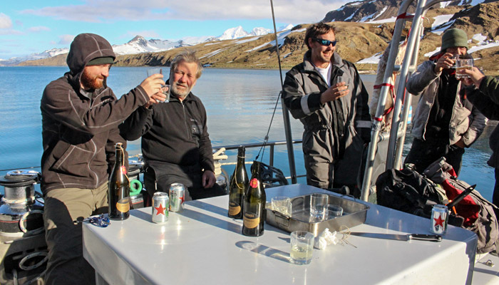
Grytviken celebrations
We retreated back to Grytviken and King Edward Point, the administrative base on the island, for R&R and a debrief. Professor Paul Mayewski had the base personnel totally focused with a great presentation of how and why an abrupt climate change could happen (beyond the scope of this article!) and what it could mean specifically for the island, if say the sea level rises which is thought at some point inevitable. Grab your kit bags lads and ladies and be prepared to head for the high ground! The Climate Change Institute team, depending on favorable results of this survey, would plan to return for a deeper drilling operation in a few years time, to unlock what could be the island’s climatic future. They tell me I will be driving a snow mobile for that one, rather than slogging my guts out pulling a sled! Skip Novak
View Slide and video show of the expedition